Description
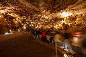
From the Lourdes Tourism website: 20,000 years ago, at the end of the Ice Age, the water from the melting glaciers infiltrated and hollowed out the Pic du Jer at its summit. Rocky debris was deposited and blocked the entry to the caverns, leaving a passage of only several meters into the mountainside. Work was undertaken to link up the various natural crevices and cavities situated beneath the Pic.The network has been open to the public since 1958.
Accessibility Information
From www.lourdes-infotourisme.com: Accessible to manual wheelchairs.
Photos
Map
No Records Found
Sorry, no records were found. Please adjust your search criteria and try again.
Google Map Not Loaded
Sorry, unable to load Google Maps API.
Reviews


